Forecasting thunderstorms is one of the trickiest (and most fun) thing a meteorologist can do. To do this we use a wide variety of charts and information in order to ascertain not only how unstable the atmosphere is, but whether the realisation of this energy will take place.
CAPE (Convective Available Potential Energy) is a theoretical value. It basically tells us how much potential energy a parcel of air has in relation to its surroundings based on temperature.
Imagine if you had a balloon and filled it with ice cold air and released it. It would fall to the ground as the temperature of the parcel would be lower than that of its surrounds. If the balloon was filled with warm air then it would rise, and carry on rising all the time it was warmer than its surroundings. The warmer the parcel (or balloon) the faster it would rise.
![]()
CAPE is calculated using Joules per kilogram which is a unit of energy. The higher the CAPE the more likely that storm clouds will build vertically quickly with accompanying updrafts. This is important, as the stronger the updraft, the more likely the systems which develop will be able to support larger sizes of hail as well as stronger downdrafts in the systems (what goes up must come down).
In general we use the following index for CAPE :-
1-1500 j/kg - Positive CAPE
1500-2500 j/kg - Large CAPE
2500+ j/kg - Extreme CAPE
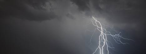
Once the CAPE values start encroaching towards the 2500 j/kg value you can start expecting hail to form within systems as well as more frequent lightning/thunder.
Sometimes though, forecasts bust. You may see large CAPE values being forecast and meteorologists talk of the risk of storms but they don't develop.
The reason for this is usually that even though there was the potential for high CAPE values, the energy was never released due to a low level CAP in the atmosphere which stopped the process bring triggered.
The other reason is that CAPE can be very localised, especially in a mixed airmass. This can mean that models may over compensate the availability of CAPE across a region, but in reality there may only be a few local regions which actually have this amount of potential to develop storms.