Cloudwatcher Sent in this image from -33.7473/150.6464
Overnight stayed fairly mild with a light southerly and we dropped down to 14.3 c . Most of the recorded rain of 29 mm , fell in the downpour yesterday afternoon with a lot of heavier rain missing us overnight ! A sign of brightness before sunrise!
Image sent in by Cloudwatcher
Overnight stayed fairly mild with a light southerly and we dropped down to 14.3 c . Most of the recorded rain of 29 mm , fell in the downpour yesterday afternoon with a lot of heavier rain missing us overnight ! A sign of brightness before sunrise!
Stu (by the Thames) Sent in this image from Catford
The above cloud...as nice as it looked...never quite made it to shower status. The wind is still variable, with an E'rly quarter, with a current temperature of 14c.
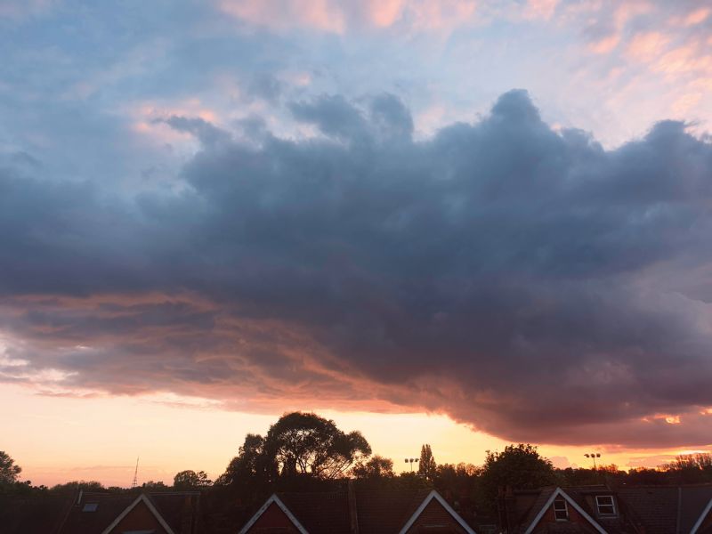
Image sent in by Stu (by the Thames)
The above cloud...as nice as it looked...never quite made it to shower status. The wind is still variable, with an E'rly quarter, with a current temperature of 14c.
“Not many clouds ⛅️ in Jersey today Stu. It’s our annual Boat Show weekend . Even a galleon has made it into Jersey waters ! ”
Stu (by the Thames) Commented Yesterday at 19:49
“Evening ANNE...oh wow. What a sight😃. I remember my days of living in S Essex, right by the Thames, with the old Thames Sailing barge race. Quite a spectacle to see days of old ⛵”
“STU I like that, just imagine how much water is in that? But these are the cloud formations that get some people learning in Meteorology. Good photo😊 ”
When Metcheckers aren't getting their latest weather fix on the site they tend to be taking stunning pictures of clouds. After all, we all love looking at beautiful sunsets, mist on a spiders web and clouds shaped like thingies don't we?
Take a look at the latest images uploaded and if it inspires you to take some picture then please feel free to upload them by using the feature at the bottom of the page.
Taken a great weather photo?
It's so easy to upload it to our gallery. All you have to make sure is that the image is a jpeg and on your hard drive. Then select the image, click upload and we'll create a thumbnail and full size image for all Metcheck viewers to enjoy.
High pressure arrives next week bringing some much needed drier weather to many regions but not for all...
Added : 17 hours ago
A lot of cloud across Britain and Ireland, sunshine for Japan and the effects of sea breezes along the eastern seaboard of America...
Added : 14 hours ago
Patchy rain across north-western regions with sunnier conditions in the south and the far northwest of Scotland...
Added : 12 hours ago
Want to see where precipitation is dropping out of the sky right now across the UK? No worries, check out the 15 minute radar below which loops through the last 6 hours of information.
Toys Similar To This :-
Whoah! How clever is this? The Metcheck Thunderstorm Tracker Satellite allows you to see the developing storms across Western Europe and tells you whether they are growing or decaying. Every 15 minutes we take a snapshot of the cloud cover then measure the temperature and height of the clouds and show you whether the area of clouds are developing into thunderstorms and what direction they are moving in.
Toys Similar To This :-
Live weather data from around the country displayed on Google Maps
Toys Similar To This :-
These are the latest NCEP GFS model weather charts at Metcheck.
Toys Similar To This :-
You probably hear a lot about the Jet Stream in the news. It's either too far North or too far South. The jet stream is identified as winds at 300mb (during Winter) and 200mb (during Summer). It is these winds which are responsible for driving and developing weather systems across the Atlantic.
Metchecks own GHX model charts out to 240 hours ahead
Toys Similar To This :-
The Metcheck 7 Day Forecast takes the best from the GFS weather models and displays it in easy to read maps for the UK out to the next 192 hours ahead.
The Metcheck 7 Day Forecast takes the best from the GFS weather models and displays it in easy to read maps for the UK out to the next 192 hours ahead.
Showing you where frost and ice is expected to develop out to 16 days ahead.